Subject: North Carolina
Period: 1809 (dated)
Publication: American Coast Pilot
Color: Black & White
Size:
16.2 x 6.9 inches
41.1 x 17.5 cm
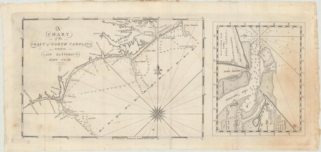
This important chart (10.3 x 6.7") is based upon the surveys of Jonathan Price and Thomas Coles as requested by President Thomas Jefferson. It shows the coastline in good detail with numerous soundings, shoals and currents noted. Jefferson was specifically worried about the dangers that the Outer Banks presented to American ships, and his concern led to the founding of the U.S. Coast Survey the following year. To the right of the chart is a small detailed map (6.5 x 5.2") of the waters surrounding Ocracoke and Shell Castle with individual buildings identified.
References: Schwartz & Ehrenberg p. 221.
Condition: B+
Issued folding and now flat with some staining at right and faint dampstains at top. There are a few minor spots of foxing along the bottom border.