Subject: New York
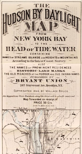
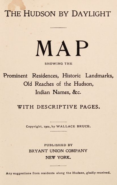
Period: 1902 (published)
Publication:
Color: Hand Color
Size:
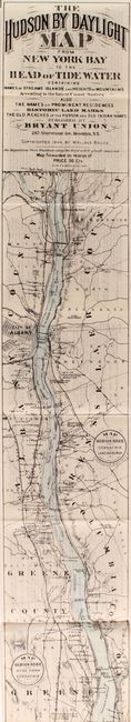
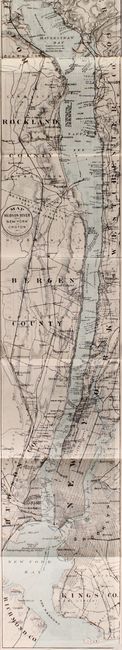
108.2 x 5.4 inches
274.8 x 13.7 cm
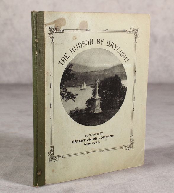
A remarkable map in strip-chart format that is over 100 inches long! Includes amazing detail that is drawn on a scale of 1.5 miles per inch. Complied from U.S. Coast Survey data, this extraordinary map includes the names of prominent residences along the Hudson, historical landmarks and Indian names. Blank verso. Complete with 30 pages of text and illustrated with photographs. Folds into paper wrappers entitled "The Hudson By Daylight." The map is dated 1894, but the pamphlet was published in 1902 by Bryant Union Company in New York.
References:
Condition: A
The folding map is clean, bright, and near fine with some light show-through from text on verso. Text is very good with even light toning. Paper wrappers have light wear and a few small stains.