Catalog Archive
Auction 177, Lot 221

"[Lot of 2] Map of the Harbors of Duluth, Minn., and Superior, Wis. June 30, 1893. Sheet 1... [and] ... Sheet 2...", U.S. Corps of Engineers

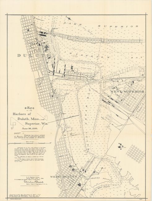
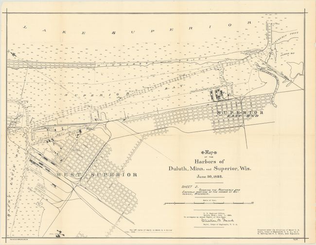
Subject: Duluth, Minnesota & Superior, Wisconsin

Period: 1893 (dated)

Publication:

Color: Black & White

Size:
See Description
Download High Resolution Image
(or just click on image to launch the Zoom viewer)

These two maps together depict Superior Bay and Saint Louis Bay between Duluth, Minnesota and Superior, Wisconsin. Together they feature excellent detail with numerous soundings, shoals, beacons and docks in the waters. On land, many industrial facilities are located including steel works, electrical works, saw mills, flour sheds, railroads, and more. Signed in the plate by the Clinton B. Sears, Major of the Corps of Engineers. These two maps were issued in the 1894 Annual Report of the Corps of Engineers, and were compiled to demonstrate the need for infrastructure improvements.

A. Sheet 1 (17.9 x 23.4").
B. Sheet 2 (23.6 x 18.0").

References:

Condition: A

Issued folding and now flattened and backed with tissue.

Estimate: $200 - $230

Sold for: $150

Closed on 4/29/2020

Archived