Subject: Minnesota
Period: 1893 (dated)
Publication:
Color: Printed Color
Size:
30.6 x 35 inches
77.7 x 88.9 cm
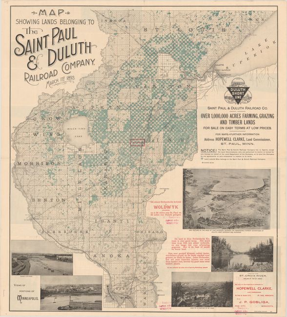
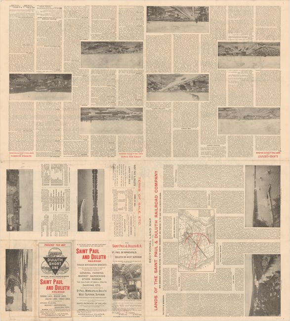
This promotional map was created to encourage Dutch immigration to Minnesota. Created by the Saint Paul & Duluth Railroad Co., the map shows the lands owned by the company in blue, touting "over 1,000,000 acres farming, grazing and timber lands for sale on easy terms at low prices." This special edition was created for the Dutch market, with red overprinting identifying the Dutch colony of Woldwyk, approximately half-way between St. Paul and Duluth. Additional Dutch text explains that the land is available for 12.5 guilders per acre with long repayment terms, and also praises the quality of the land. The map shows a portion of eastern Minnesota bounded by Minneapolis and St. Paul in the south, the Mississippi River in the west, the border with Wisconsin in the east, and extends past Duluth in the north. The land is divided into townships based on the Public Land Survey System. Photos of Minneapolis, St. Paul, and the St. Croix River and a pictorial view of Duluth and the head of Lake Superior are included as additional evidence of the beauty of the region. On verso are numerous images and descriptions of places in Minnesota.
References:
Condition: A
A bright and clean example, issued folding with a few short fold separations.