Subject: Martha's Vineyard, Massachusetts
Period: 1848-1940 (circa)
Publication:
Color: Black & White
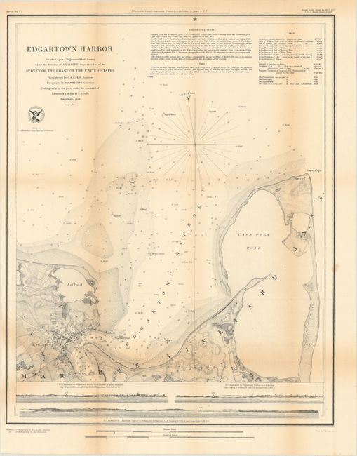
A. Edgartown Harbor, by U.S. Coast Survey, dated 1848 (14.1 x 17.5"). An attractive chart with good detail on land as well as the coastline. Filled with hundreds of soundings, anchorages, hazards, bottom type and light houses. At bottom are three profile views showing the entrance to Edgartown Harbor. Produced under the direction of A.D. Bache and printed by D. McLellan. Condition: Issued folding with light toning along the fold lines and two small fold separations that have been closed on verso with archival tape. (B+)
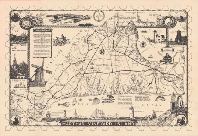
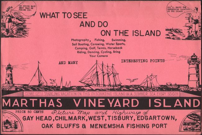
B. Marthas Vineyard Island, by New England Map Co., circa 1940 (21.2 x 14.2"). A handsome pictorial map of Martha's Vineyard with an emphasis on the road network. Surrounded by a series of vignettes representing the region including a nice view of Edgartown Harbor at top. Beneath this view is a table displaying the colonial history of the island. Promotional text encourages the reader to "Come get a sparkling vacation on this fascinating island in a summer sea every season." Folds into pink pictorial wrappers. Condition: Near fine with one tiny tear in the top right corner that has been closed on verso with archival tape. (A)
References:
Condition:
See description above.