Catalog Archive
Auction 177, Lot 207

"Geographical, Statistical, and Historical Map of Indiana", Carey & Lea
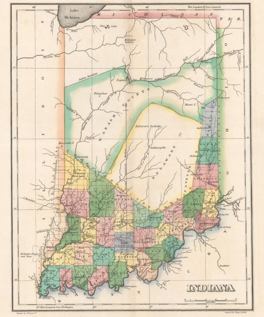
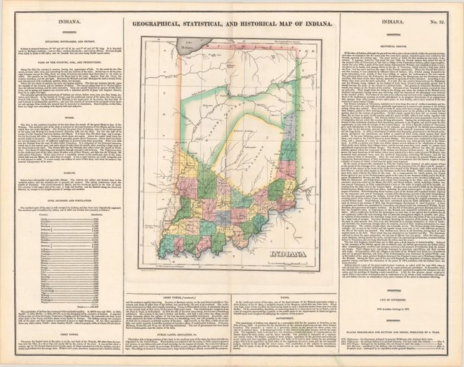
Subject: Indiana

Period: 1822 (published)

Publication: A Complete Historical, Chronological, and Geographical American Atlas

Color: Hand Color

Size:
8.8 x 11.2 inches
22.4 x 28.4 cm
Download High Resolution Image
(or just click on image to launch the Zoom viewer)

The map is on a full folio sheet (20.9 x 16.6") surrounded by English text giving a brief description of Indiana's boundaries, rivers, climate, chief towns, government, and history. The finely engraved map delineates the counties, roads, and major towns. Development is confined to the southern portion of the state, with the large Delaware and Wabash counties occupying the middle of the state. The Indian Boundary line is prominently depicted in the north. Drawn by Fielding Lucas, Jr. and engraved by Young & Delleker.

This map was previously part of the Credit Suisse Americana Collection.

References: Phillips (Maps) p. 333.

Condition: A

Contemporary color with minor toning along the centerfold.

Estimate: $200 - $230

Sold for: $230

Closed on 4/29/2020

Archived