Subject: Florida
Period: 1913 (dated)
Publication:
Color: Printed Color
Size:
11 x 14.5 inches
27.9 x 36.8 cm
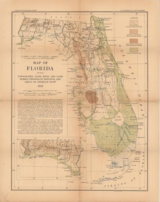
This scarce map first appeared in the second annual report of the Florida Geological Survey (1908-09). It covers the entire state with the western panhandle depicted in an inset on the same scale at bottom. The map legend identifies elevation by contour lines, artesian flow, and phosphate deposits, which are particularly concentrated in the "bone valley" region to the east of Tampa. Compiled under the direction of E.H. Sellards, State Geologist and lithographed by A. Hoen & Company in Baltimore. There are no past sales records and 4 institutional examples located on OCLC.
References:
Condition: B+
Issued folding with uniform light toning and occasional faint color offsetting.