Subject: California
Period: 1929-60 (dated)
Publication:
Color: Printed Color
This lot contains three pictorial maps of California by Ruth Taylor White:
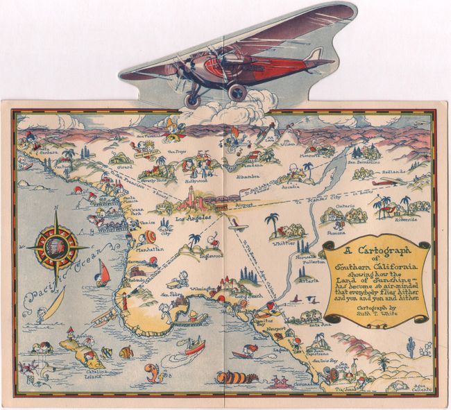
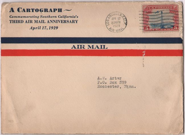
A. A Cartograph of Southern California..., dated 1929 (10.0 x 9.3"). This small pictorial map of Southern California shows "how the Land of Sunshine has become so air-minded that everybody flies hither and you and you and hither." Filled with whimsical illustrations symbolic of the region and surmounted by an unusual pop-up airplane. The verso contains promotional text and illustration for Western Air Express. Complete with stamped envelope entitled "A Cartograph Commemorating Southern California's Third Air Mail Anniversary April 17, 1929." Reference: Rumsey #8253. Condition: Near fine with manuscript note on verso. (A)
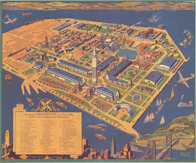
B. A Cartograph of Treasure Island in San Francisco Bay Golden Gate International Exposition, dated 1940 (19.0 x 15.6"). This pictorial map was issued in the official guide for the 1940 Golden Gate International Exposition (World's Fair) celebrating the recent opening of the two major bridges leading to San Francisco (the San Francisco-Oakland Bay Bridge opened in 1936 and the Golden Gate Bridge opened in 1937). The fair was held on Treasure Island, an artificial island created specifically for this event, in the San Francisco Bay along the route of the Bay Bridge. The map itself shows good detail of the exposition grounds with the "Tower of the Sun" in the foreground. A large scroll legend at lower left identifies 43 points of interest including the Hollywood Show and Pantheon, Ford Building, and "Vacationland" to name a few. The verso contains an index and enlarged views of several of the exposition buildings. Reference: Hornsby (Picturing America) p. 50. Condition: Fine. (A+)
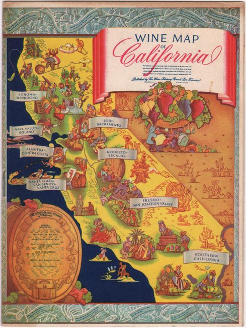
C. Wine Map of California, dated 1960 (4.4 x 5.3"). This is a postcard-sized version of Ruth Taylor White's earlier map of the wine regions (30.3 x 40.2"). According to Hornsby, it "depicts the entire state as a bounteous land full of vineyard and wine-drinking inhabitants, much different from the barren deserts of neighboring Arizona and Nevada." This smaller version served as the front cover of a program for a charity benefit (“A Tasting of Wines”) sponsored by the Wine Advisory Board. With a section on wine tasting, types of wine, and the wines to be tasted. Reference: Hornsby (Picturing America) p. 207. Condition: Minor soiling. (B+)
References:
Condition:
See description above.