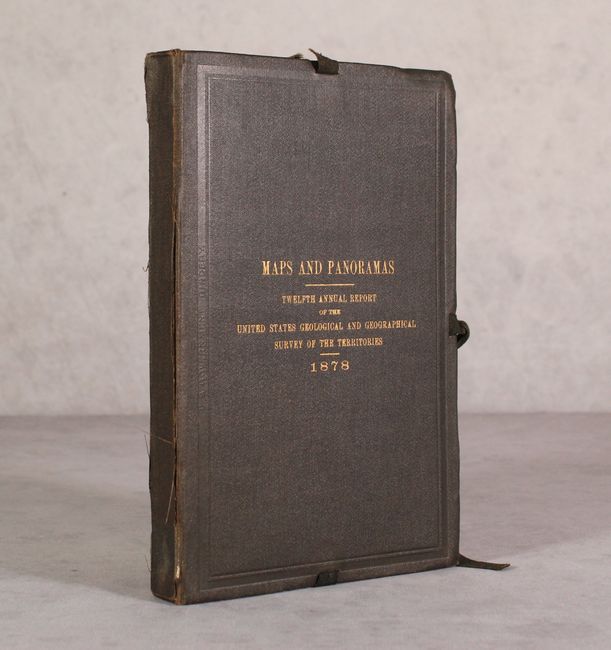
Subject: Western United States, Yellowstone National Park, Geology
Period: 1878 (dated)
Publication:
Color: Printed Color
Size:
6.1 x 9.3 inches
15.5 x 23.6 cm
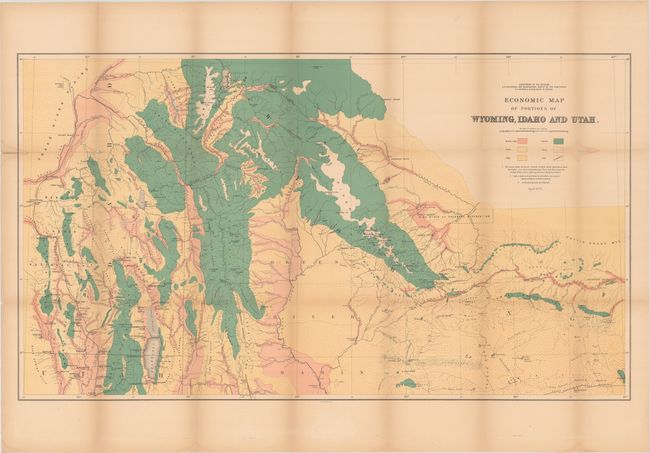
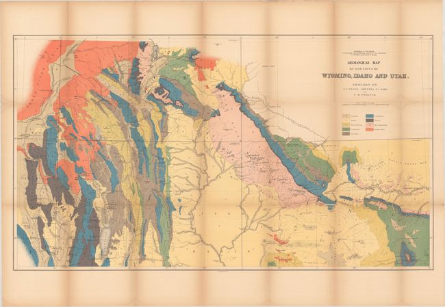
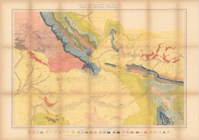
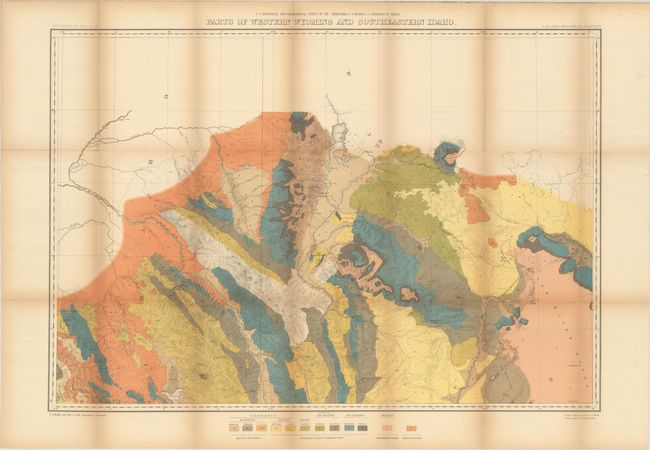
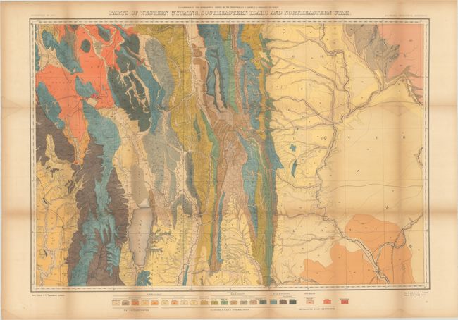
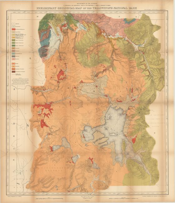
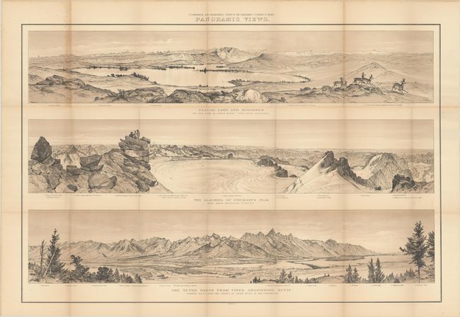
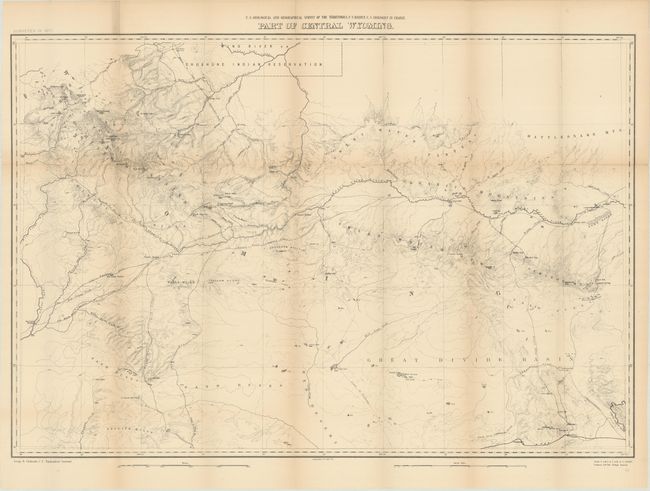
This complete set contains nine maps and one panoramic view, while the front cover pastedown lists only 6 maps and 1 panorama. The 3 additional maps are numbered 8, 9 and 10 in the upper right corner, as are the first 7, which suggests the paper label is inaccurate and that all of the maps were intended to be issued in this fashion. Seven of the maps have brilliant lithographed color showing the geology of the region, including Yellowstone and parts of Wyoming, Idaho and Utah. All fold into original hardbound covers with gilt titling.
A. Economic Map of Portions of Wyoming, Idaho and Utah, April 1879 (36.1 x 20.5").
B. Geological Map of Portions of Wyoming, Idaho and Utah (36.2 x 20.4").
C. Part of Central Wyoming (33.3 x 22.8").
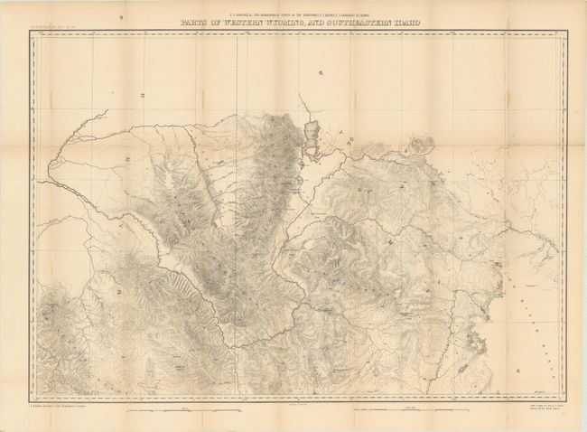
D. Parts of Western Wyoming and Southeastern Idaho (32.6 x 22.7").
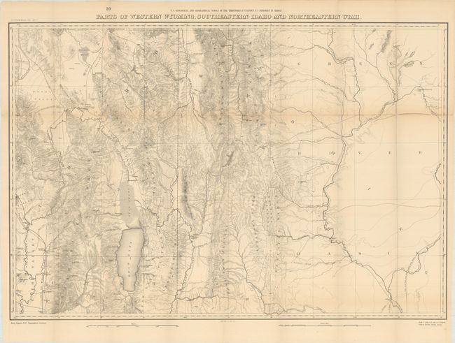
E. Parts of Western Wyoming, Southeastern Idaho and Northeastern Utah (33.2 x 22.8").
F. Preliminary Geological Map of the Yellowstone National Park (28.4 x 31.9").
G. Panoramic Views - Glacial Lake and Moraines; The Glaciers of Fremont's Peak; The Teton Range from Upper Grosventre Butte, black & white (35.0 x 23.3").
H. Part of Central Wyoming, black & white (33.1 x 22.7").
I. Parts of Western Wyoming, and Southeastern Idaho, black & white (32.7 x 22.7").
J. Parts of Western Wyoming, Southeastern Idaho and Northeastern Utah (33.3 x 22.8").
References:
Condition: B
Maps are generally good with light toning, occasional minor dampstains along the fold junctions, and numerous fold separations as is commonly seen on these maps. Map #6 has split in half along a vertical fold and is in need of basic repair (C). There is a library stamp on the verso of map #1 and a library bookplate (withdrawn) is on the front pastedown. Covers have light wear.