Subject: Dakota Territory
Period: 1874 (dated)
Publication:
Color: Black & White
This lot contains two important maps from Report of a Reconnaissance of the Black Hills of Dakota, Made in the Summer of 1874, by Captain William Ludlow, Corps of Engineers:
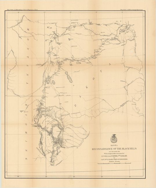
A. Map of a Reconnaissance of the Black Hills, July and August, 1874, with Troops Under Command of Lt. Col. G.A. Custer, 7th Cavalry (21.3 x 25.5"). This is Ludlow's principle map that shows the entirety of Custer's reconnaissance of 1874. The map extends from Old Ft. Pierre on the Missouri River to the Little Missouri Buttes and north to the Badlands and the Yellowstone River. In the summer of 1874, Custer took units of his 7th Cavalry and 2nd Infantry Companies on a now famous march from Ft. A. Lincoln into the Black Hills of the Dakotas. On this expedition, gold was discovered, which led to the Black Hills Gold Rush, then to Custer's massacre and eventually to the tragic end of the Sioux War at Wounded Knee. This map traces Custer's route through the region of the Black Hills with the date of each encampment. The map contains many interesting notations, such as "Where they killed the Rees," "Where the sickman was killed" plus many comments on water, grasslands, springs, etc. The topography is nicely developed and portions of Raynold's 1859 route is shown.
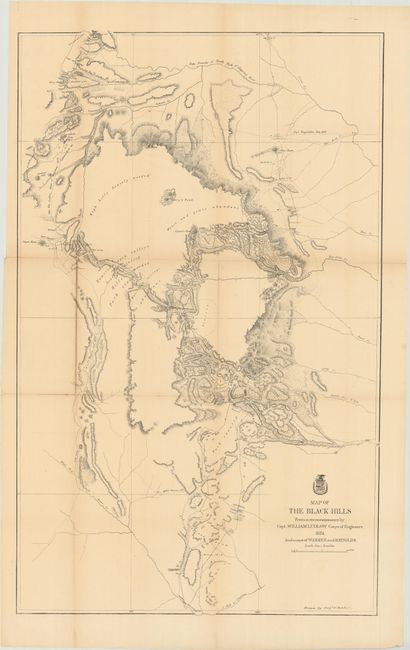
B. Map of the Black Hills from a Reconnaissance by Capt. William Ludlow Corps of Engineers (23.6 x 38.2"). A large map drawn by Sergeant C. Becker and one of three maps resulting from Custer's Expedition with additional geography from the maps of Warren and Raynolds. It covers the Black Hills between the Belle Fourche or North Fork of the Cheyenne River to the South Fork of the Cheyenne. Drawn on a scale of 3 miles=1 inch. Topography is nicely developed with portions of Warren's route of 1857 and that of Raynold's in 1859 shown. This expedition led to a discovery of gold and the subsequent Gold Rush into the Black Hills.
References: Wheat (TMW) #1248 & #1249.
Condition: B+
Issued folding and now flattened and backed with tissue to reinforce and repair several small fold separations. Light toning along the fold lines, with one tiny chip in a blank area of the first map.