Subject: Colonial Southeast United States
Period: 1757 (dated)
Publication: Prevost's Histoire Generale des Voyages
Color: Black & White
Size:
11.3 x 7.4 inches
28.7 x 18.8 cm
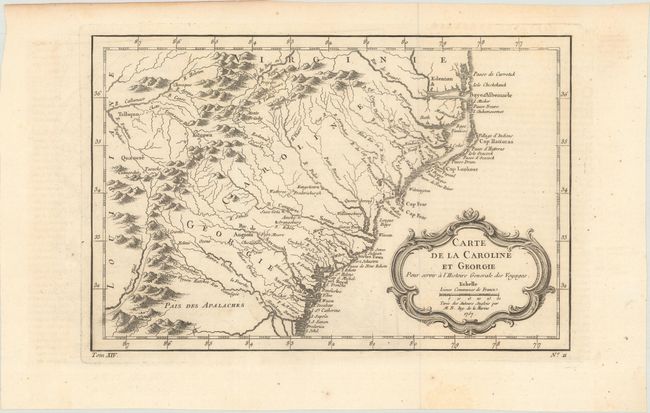
This delicately engraved map covers the colonies of Carolina and Georgia from Albemarle Sound to the Alatamaha River. It probably owes its origin to the 1752 map of the region by Emanuel Bowen. There are numerous English settlements along the coast, and Indian villages are located throughout, including a number west of the Appalachian Mountains. There is more detail in the area west of the Blue Ridge than in many other maps of the period. It shows a rudimentary course of the Tennessee River in the northwestern section of the map. A decorative rococo-style title cartouche incorporates the distance scale.
References: Cumming (SE) #311; Sellers & Van Ee #1384.
Condition: B+
A crisp impression, issued folding on paper with a bunch of grapes watermark, minor offsetting, and a few small spots of foxing.