Subject: World & Continents
Period: 1602 (published)
Publication: Breve Compendio dal Theatro
Color: Hand Color
Size:
4.9 x 3.4 inches
12.4 x 8.6 cm
Following the success of Abraham Ortelius' folio atlas, Theatrum Orbis Terrarum, Philip Galle conceived of the idea to create a pocket edition that would be accessible to a wider audience. Galle had maps engraved and published Spieghel der Wereld beginning in 1577. The pocket atlas was commercially successful and was published in several languages, however Galle was dissatisfied with the engraving of the maps and gradually replaced nearly all of them. At the same time, he changed the name of the pocket atlas to Epitome du Theatre du Monde d'Abraham Ortelius to capitalize on Ortelius' popularity. The plates were acquired by Jan Baptist Vrients circa 1600, who published three more editions in 1601 and 1602, retouching some of the plates and replacing a few more. By the time Vrients' 1601 edition was published, only 10 of the original maps remained.
This beautiful set of miniature maps is from an Italian edition of Ortelius' pocket atlas published by Vrients. Italian text on verso.
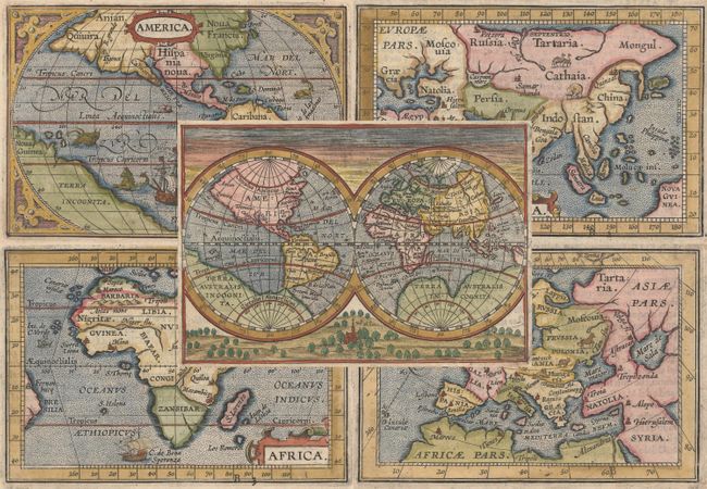
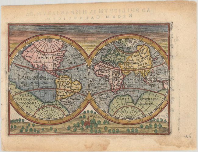
A. [Untitled - World] This double hemisphere world map is one of Vrients' additions. It is based on Jodocus Hondius' map, but is presented in an entirely original background composed of a pastoral scene with a church under dawn sky. The map shows a huge Terra Australis Incognita, and North America extends far north and west with the place names Quivira, California, Florida, and Totonteac. References: Shirley #231; Van der Krogt (Vol. III) #0001:332B.
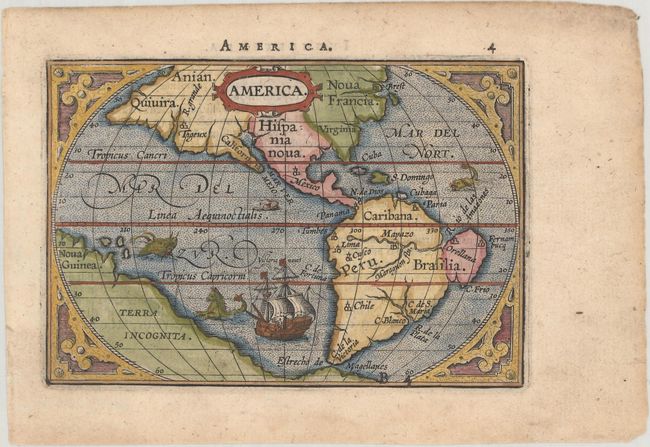
B. America. The map of America is a delicately engraved depiction of Ortelius' cartography and strapwork surround with a pair of sea monsters and a gorgeous ship. The map is lacking a great deal of detail but is interesting for a number of spurious rivers in North America, most notably two in Virginia, several feeding into the Gulf of California and the R. Grande on the west coast near Quivera. The cartography of South America shows an uncommon bulge in Brazil labeled Orellana, named after Francisco de Orellana, who descended the Amazon in 1542. References: Burden #143; Van der Krogt (Vol. III) #9000:333.
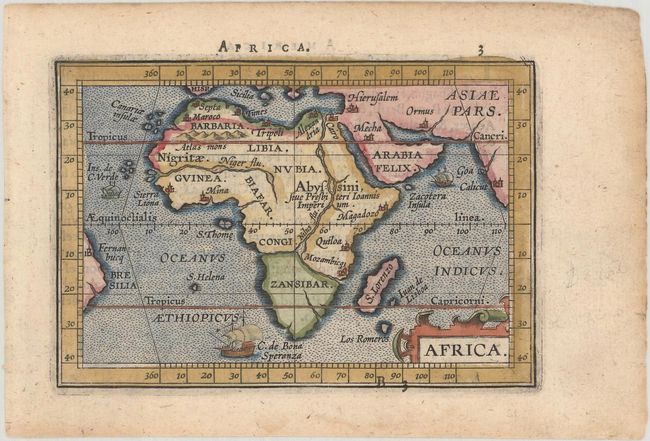
C. Africa. This handsome miniature map of Africa is lacking a great deal of detail but is interesting for its strange depiction of the Nile, which originates in a large lake south of the Equator. From this lake three large rivers flow to the seas: the Nile to the Mediterranean, the Congo to the Atlantic and what could be the Zambeze to the Indian Ocean. The map is decorated with a strapwork title cartouche and three sailing ships. References: Betz #47; Van der Krogt (Vol. III) #8600:333.
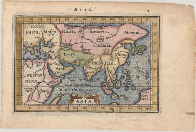
D. Asia. This charming map of Asia depicts a simplified version of the continent with depictions of an exotic elephant and camels in the interior. References: Van der Krogt (Vol. III) #8000:333.
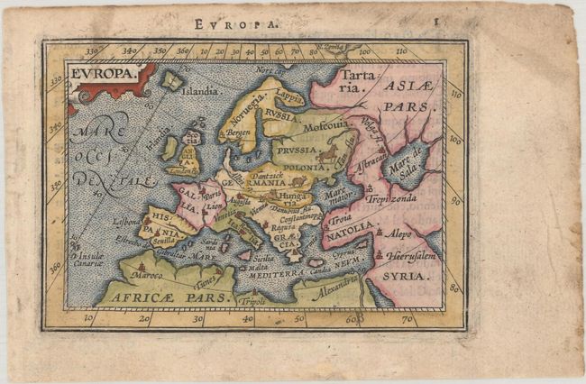
E. Europa. This miniature map of Europe is enclosed in a wide border marking the degrees of latitude and longitude and is beautifully engraved with stippled seas and tiny animals throughout the interior. References: Van der Krogt (Vol. III) #1000:333.
References: King (2nd Ed.) pp. 64-65 & 88-89.
Condition: A
Crisp impressions with minor damp stains and soiling in the blank margins, except the map of Europe, which has light overall soiling. The maps of the world, Asia, and Europe have chips confined to the blank margins that have been professionally repaired.