Subject: World & Celestial
Period: 1720 (circa)
Publication: Atlas Historique...
Color: Hand Color
Size:
23.8 x 19.4 inches
60.5 x 49.3 cm
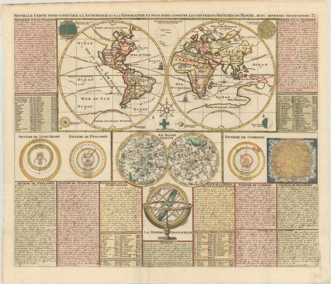
This great sheet combines a large, double-hemisphere world map with a celestial map and several astronomical diagrams into a unique composition. The world map shows California as an island with the coastline of the Pacific Northwest stretching nearly to Asia. This map includes a particularly extraordinary version of Terres Australes Inconnues; it is shown across the entire base of the map and is connected to Australia. There is no sign of New Zealand or any other Pacific islands. The voyages of Drake, Cavendish, and others are shown, and several ships sail the oceans. Surrounding the map are illustrations of the sun, moon, planets, an armillary sphere, the double hemisphere celestial chart, and the solar system theories of Ptolemy, Tycho Brahe, Copernicus and Descartes. Tables of extensive French text provide explanations of the diagrams.
References:
Condition: A+
Excellent impression on a bright sheet with a "K" watermark, issued folding, with minor soiling along the edges of the sheet.