Subject: North America, Texas
Period: 1850 (circa)
Publication: Atlas Universel Illustre
Color: Hand Color
Size:
16.8 x 10.9 inches
42.7 x 27.7 cm
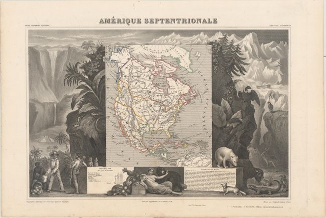
Victor Levasseur's "Atlas National Illustre" and "Atlas Universel Illustre" are among the last decorative atlases published. The maps are all lavishly illustrated with scenes of the countryside, products and activities indigenous to the region.
This richly engraved map of North America shows the United States' claims into present-day Canada reflecting the Oregon boundary dispute. The Republic of Texas is shown, and Mexico's northern border is drawn according to the Treaty of 1819 (here misprinted as 1810). Russia is in control of Alaska. The map is surrounded by beautifully engraved scenes of North and Central America including wildlife, a ship stranded in the polar sea and a Mayan temple.
References:
Condition: A
Contemporary outline color with minor scattered foxing and a couple tiny holes that are only visible when held up to light.