Subject: North America
Period: 1799 (dated)
Publication:
Color: Hand Color
Size:
17.9 x 15.5 inches
45.5 x 39.4 cm
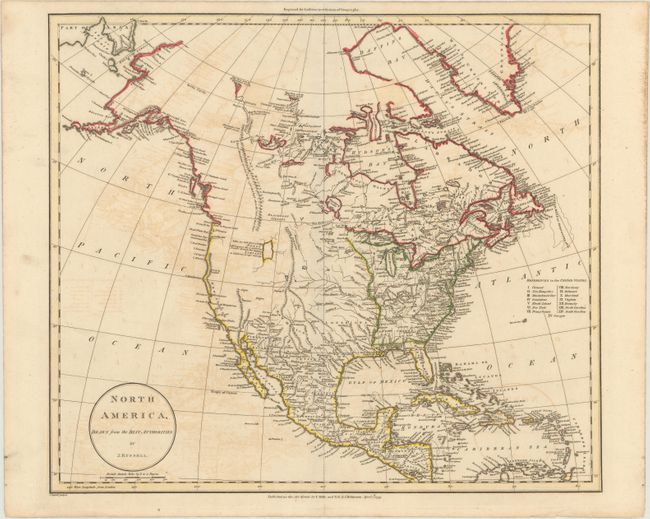
John Russell introduced an entirely new feature to the topography of North America by showing a long range of Stony Mountains in the west (first depicted on his 1794 map). At the northern tip of the mountain range are Mountains with bright stones with the discoveries of Hearne and Mackenzie shown in the Arctic. A large lake occupies the space where the Great Salt Lake actually lies, with the notation "Lake &c. laid down according to Mr. Lawrence, who is said to have travell'd through this Country to California in 1790 and 1791." The headwaters of the Colorado, Rio Grande, and Missouri rivers appear in close proximity to each other. Juan de Fonca's Inlet appears in the general vicinity of Seattle and there is no Vancouver Island. The United States are confined east of the Mississippi where 15 states are identified. Maine is not named and is given a very squat shape. Published by Dilly & Robinson in London.
References: cf. Wheat [TMW] #228.
Condition: B
On watermarked paper dated 1799 with some offsetting.