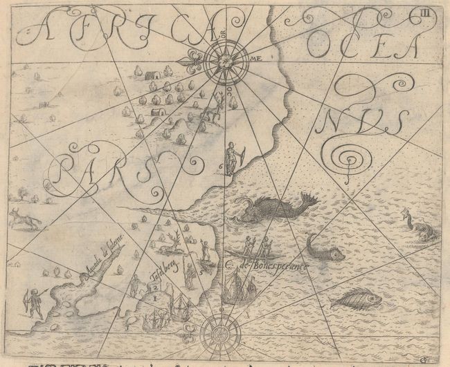
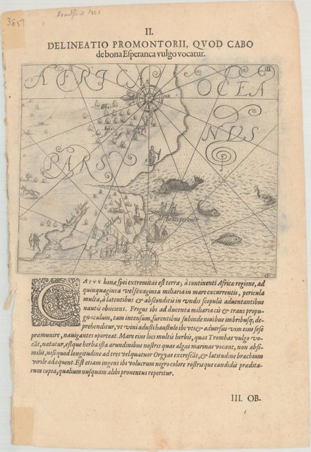
Subject: Cape of Good Hope, Southern Africa
Period: 1606 (circa)
Publication: Petits Voyages, Part VII
Color: Black & White
Size:
6.6 x 5.4 inches
16.8 x 13.7 cm
This copper engraving is from a remarkable series of publications, illustrating voyages of discovery and travels of exploration to various parts of the world. The project was begun by Theodore de Bry of Frankfurt, in 1590 and was to continue for another 54 years. They became known collectively as the Grands Voyages (to America and the West Indies) and the Petits Voyages (to the Orient and the East Indies). De Bry died after the first six parts of the Grands Voyages were completed. The project was completed initially by his widow and two sons, Johann Theodore de Bry and Johann Israel de Bry, then by Johann Theodore's son-in-law, Matthaus Merian, in 1624.
This map of Table Bay, approximately 15 miles north of the Cape of Good Hope, is oriented with north to the left. Table Bay was named such by the Dutch due to the high, flat mountain near the coast. The engraving is embellished with a lovely compass rose, ships, natives, land animals, and sea monsters. On a sheet of Latin text measuring 7.6 x 11.4".
References:
Condition: B+
A few extraneous creases and light show-through of some staining on verso.