Catalog Archive
Auction 176, Lot 669

"Carte de la Coste Orientale d'Afrique Depuis le XIIIe. Degre de Latitude Meridionale Jusqu'au XVIe. Degre de Latitude Septentrionale...", Bellin, Jacques Nicolas

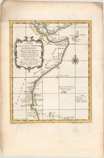
Subject: Eastern Africa

Period: 1740 (dated)

Publication: La Harpe's Histoire Generale des Voyages

Color: Hand Color

Size:
7.8 x 9.7 inches
19.8 x 24.6 cm
Download High Resolution Image
(or just click on image to launch the Zoom viewer)

This map shows the east coast of Africa from the Red Sea and the Gulf of Aden to Tanzania with many coastal place names. The map covers the coast from Arkiko, Eritrea to C. del Gada in Tanzania, showing the Comoros Islands offshore. Decorated with an ornamental title cartouche featuring scroll motifs and a compass rose. The map was commissioned by Jean-Frédéric Phélypeaux, Count of Maurepas.

References:

Condition: A

Issued folding on watermarked paper with minor offsetting, marginal soiling, and a small hole in the right blank margin.

Estimate: $70 - $95

Sold for: $50

Closed on 2/12/2020

Archived