Subject: Egypt
Period: 1845 (circa)
Publication:
Color: Hand Color
Size:
29.5 x 21.2 inches
74.9 x 53.8 cm
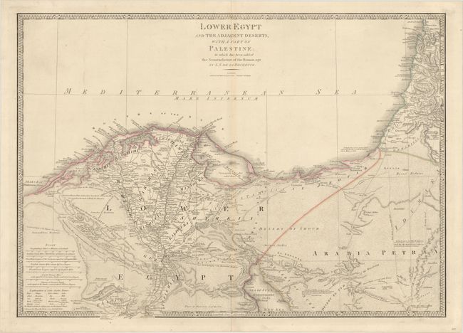
This beautifully engraved map covers the region from Arab's Gulf to the delta of the Nile and into the Holy Land. It extends to north of Mt. Carmel and south to well below Memphis to Atsieh, Aphroditopolis, and Ellahoun. Scores of villages are located, and numerous roads, trails, and camel routes are detailed and often named: for example, "Derb el Fern - Upper Road belonging to the Haouatat Bedwins." The map is fully and very finely engraved in the deserts to simulate sand. It delineates the Lake of Menzaleh near the mouth of the Nile. In the bottom left corner there are seven distance scales and a table that gives the translation for some common Arabic names. This map is Wyld's reissue of Faden's map of 1802. Delarochette, who also worked with Faden, is responsible for the remarkable engraving.
References:
Condition: B+
On a sturdy sheet with light toning along the centerfold and centerfold separations at top and bottom that have been archivally repaired on verso.