Subject: Africa
Period: 1792 (dated)
Publication:
Color: Hand Color
Size:
23.2 x 18 inches
58.9 x 45.7 cm
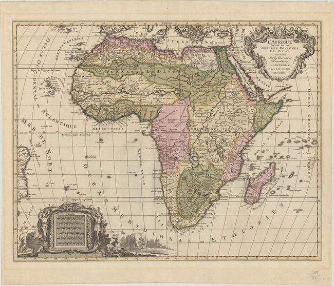
This handsome, large map of Africa was copied from Jaillot's popular and influential map from more than a century earlier (1674). The cartography is typical for the seventeenth century with the Nile originating in two large lakes below the equator. The River Zaire (Congo) also arises from Lake Zaire. The Kingdom of Monomotapa is shown with its capital on the Rio de Spirito Santa, and Vigiti Magna is also depicted. The map is richly embellished, also in the seventeenth century style, with two elaborate cartouches featuring allegorical figures and wild animals.
References: Norwich #109.
Condition: A
Contemporary color on paper with two elephant watermarks with some minor spots of color offsetting. Faint toning in the blank margins.