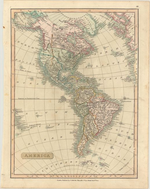
Subject: Western Hemisphere - America
Period: 1820 (dated)
Publication: Smith's New General Atlas
Color: Hand Color
Size:
10.3 x 13.7 inches
26.2 x 34.8 cm
A handsome English map of the Americas that extends east to show the western coasts of Europe and Africa. The United States is shown stretching to the Pacific Ocean with Mexico in control of the Southwest. In the Pacific Northwest, the boundary between the United States and Canada is shown along the Columbia River, reflecting British claims in the region. Alaska's shape is relatively correct and a small portion of the eastern Asian coastline is shown along the top border. Near the Antarctic Circle, the South Shetland Islands are depicted, which were discovered the year before (1819) by British mariner William Smith.
References: Phillips (Atlases) #6042.
Condition: B+
Light soiling.