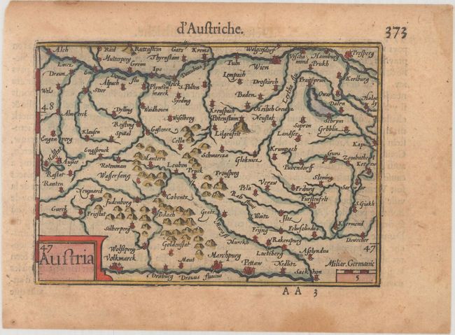
Subject: Austria
Period: 1600 (published)
Publication: Thresor de Chartes
Color: Hand Color
Size:
4.8 x 3.3 inches
12.2 x 8.4 cm
This miniature map covers the heart of Austria bounded in the north by the Danube and in the south by the Drava rivers. French text on verso.
The map was first published by Cornelius Claesz and printed by Barent Langenes in the 1598 edition of the popular Map-treasury. For the 1599 edition, graduation lines and latitude numerals were added to one side of the border on most of the maps, which were again used for multiple editions through 1650. This is the second state with the added graduation lines from a French edition, printed by Albert Hendricks.
References: King (2nd ed.) p. 80-82; Van der Krogt (Vol. III) #2710:341.
Condition: B+
Light toning and foxing with a small damp stain confined to the blank margin.