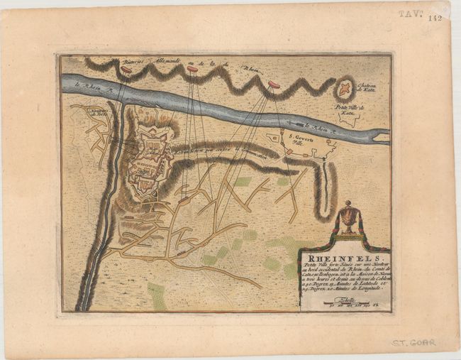
Subject: Rheinfels, Germany
Period: 1705 (circa)
Publication: Les Forces de l'Europe…
Color: Hand Color
Size:
10.4 x 8.1 inches
26.4 x 20.6 cm
Nicolas de Fer held the title of geographer at Louis XIV's court. He was one of the most prolific publishers of plans of European cities in the late seventeenth century. The fortifications plans in Les Forces de l'Europe were designed to teach fortification techniques. Engraved by Van Loon and Schoonebeek after French engineers under the command of Vauban, the renowned military architect. The illustrations often include a description and a legend with the principal buildings; each city plan includes both fortifications and street layout.
This plan shows the fortress of Rheinfels near St. Goar, one of the largest castles on the Rhine. It illustrates the French siege of 1692 in which the Hessians, with a force of only 4,000 men, defended it against an army of 28,000 soldiers. Nicolas de Fer held the title of Geographer at Louis XIV's court. He was one of the most prolific publishers of plans of European cities in the late seventeenth century.
References:
Condition: A
Minor marginal toning.