Catalog Archive
Auction 176, Lot 463
"Carte de l'Etat de la Cour Imperiale et des Etats Hereditaires de la Maison d'Autriche avec Leurs Diverses Chanceleries", Chatelain, Henry Abraham
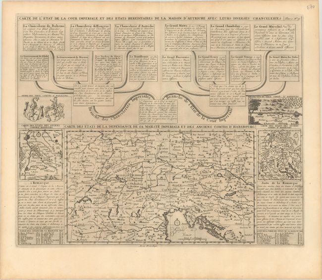
Subject: Central Europe, Austria
Period: 1720 (circa)
Publication: Atlas Historique
Color: Black & White
Size:
18.4 x 14.8 inches
46.7 x 37.6 cm
Download High Resolution Image
(or just click on image to launch the Zoom viewer)
(or just click on image to launch the Zoom viewer)