Catalog Archive
Auction 176, Lot 378
"Carte du Gouvernement Militaire d'Angleterre ou l'on Represente l'Etat des Officiers de Guerre et Celui des Forces de Terre et de Mer", Chatelain, Henry Abraham
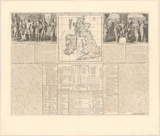
Subject: Britain
Period: 1720 (circa)
Publication: Atlas Historique
Color: Black & White
Size:
18.1 x 13.3 inches
46 x 33.8 cm
Download High Resolution Image
(or just click on image to launch the Zoom viewer)
(or just click on image to launch the Zoom viewer)