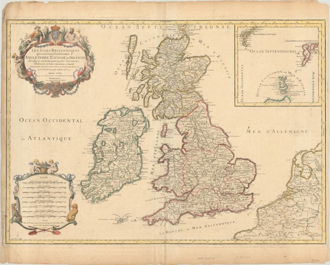
Subject: Britain
Period: 1709 (dated)
Publication: Atlas Francois
Color: Hand Color
Size:
25.5 x 17.9 inches
64.8 x 45.5 cm
This is an attractive map of the British Isles filled with fine detail of hundreds of place names. The map has two decorative cartouches, including the title cartouche with putti, Neptune, a merman and mermaid, and the French coat of arms. The second cartouche contains eight distance scales and is adorned with a pair of putti and hunting dogs. Jaillot was the successor to the Sanson publishing family and this map follows the geography of Nicolas Sanson, as well as the previous work of Saxton, Speed, Pont, Gordon, and Boazio. A large inset details the Shetland, Faroe, and Orkney Islands. The map was engraved by Cordier, who appears to have copied an early plate from a previous Jaillot map of Britain. The cartouches were engraved by Simmoneau, whose signature S[immoneau] f[ecit] appears below each. This is the third state, dated 1709.
References: Shirley (BI to 1750) Jaillot 3.
Condition: B+
On a sheet with contemporary outline color and a Maltese cross watermark. There is light soiling, minor spots, and some minor edge tears and chips in the margins, with one archivally repaired tear that just passes the neatline at left.