Subject: Lima, Peru
Period: 1671 (circa)
Publication: America...
Color: Hand Color
Size:
13.8 x 11.3 inches
35.1 x 28.7 cm
Montanus' work was perhaps the greatest illustrated book on the New World produced in the seventeenth century. It contained over one hundred beautifully engraved plates, views, and maps of North and South America. The plates vividly depict forts, festivals, occupations, Dutch fleets, battles, religious rites, and customs of the native inhabitants. This important work was translated into German by Olivier Dapper, and into English by John Ogilby. Several of the plates were later acquired by Pierre Vander Aa.
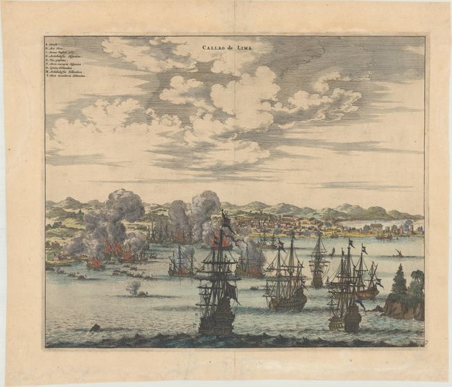
This great view illustrates the defeat of the Peruvian Fleet by the Dutch admiral, Joris van Speilbergen, off the coast of Peru in 1615. The legend at upper left identifies the buildings onshore and indicates which ships are Spanish or Dutch.
References:
Condition: A
A sharp impression on paper with a fleur-de-lis coat of arms watermark, marginal soiling, and archivally repaired centerfold separations confined to the top and bottom blank margins.