Subject: Peru
Period: 1643 (circa)
Publication: Theatre du Monde ou Nouvel Atlas
Color: Hand Color
Size:
19.4 x 14.8 inches
49.3 x 37.6 cm
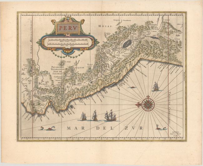
Beautifully engraved map based on the cartography of Hessel Gerritsz. The map covers the Pacific coast of South America from Ecuador as far south as the Atacama Desert in the northern reaches of Chile. It includes the Potosi silver mines, Titicaca, Cusco, Quito and numerous other towns and villages. The dramatic strapwork cartouche incorporates both the title and the distance scales. A large compass rose orients the map with north to the left. It is further decorated with four Spanish galleons and three sea monsters. This is one of the plates that Blaeu acquired from the widow of Jodocus Hondius in 1629. French text on verso, published between 1643-50.
References: Van der Krogt (Vol. II) #9820:2.2.
Condition: A
Excellent impression on a bright sheet with light printer's ink residue and a minor crease at bottom right.