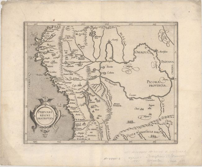
Subject: Peru
Period: 1597 (circa)
Publication: Descriptionis Ptolemaicae Augmentum…
Color: Black & White
Size:
11.3 x 9 inches
28.7 x 22.9 cm
This important early map of Peru is finely engraved with numerous cities located throughout. Lake Titicaca is elongated and joined with Aulaga Lake. The map is embellished with a large strapwork title cartouche and a stipple engraved sea. This is the second state of the map, with the date removed from the title cartouche. The first state appeared in Wytfliet's Descriptionis Ptolemaicae Augmentum… in 1597, which is considered the earliest atlas to focus on the Americas.
References: Mickwitz & Miekkavaara #308-6.
Condition: A
A dark impression on paper with a crown watermark and marginal soiling. There are pencil notations confined to the bottom blank margin.