Subject: Cap Haitien, Haiti
Period: 1733 (published)
Publication: Histoire de l'Isle Espagnole ou de S. Domingue
Color: Hand Color
Size:
9.1 x 7.4 inches
23.1 x 18.8 cm
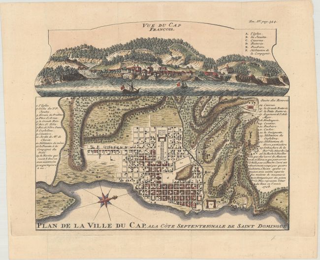
This superb bird's-eye plan depicts the important port city of Cap Francois on the island of Saint Domingue, now known as Cap Haitien, Haiti. Saint Domingue was a French colony established on the island of Hispaniola in 1659, and Cap Francois, established circa 1670, was the capital. This plan shows the block-street pattern in detail, with important locations identified in a numbered key. A notation explains that the plan depicts the city in 1728, and a compass rose orients north to the right. Above the plan is a panoramic view of the city. This map is very rare and seldom appears on the market.
This plan was published in Pierre Francois Xavier de Charlevoix's early and extensive history of the Caribbean focused on Saint-Domingue. Charlevoix was a French Jesuit who spent time in Quebec, St. Louis, and New Orleans before arriving in Saint-Domingue.
References: Shirley (BL Atlases) G.CHAR-1b.
Condition: A
A crisp impression, issued folding and now flattened.