Subject: Caribbean
Period: 1827 (dated)
Publication: A New General Atlas
Color: Hand Color
Size:
20.3 x 15.9 inches
51.6 x 40.4 cm
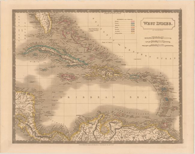
This handsome map focuses on the Caribbean and includes parts of Central America and northern South America, giving good inland detail of rivers, lakes, topography and towns. A color-coded key identifies the British French, Spanish, Dutch, Danish, and Swedish possessions, as well as independent areas. A note in the Atlantic Ocean explains that the first identified land in the Americas was Cat Island by Christopher Columbus in 1492. Published by Longman, Rees, Orme, Brown and Green.
References:
Condition: A
A dark impression with contemporary color on a sturdy sheet, with marginal soiling.