Subject: Gulf of Mexico & Caribbean
Period: 1681 (circa)
Publication: Zee-Atlas
Color: Hand Color
Size:
23.6 x 20.4 inches
59.9 x 51.8 cm
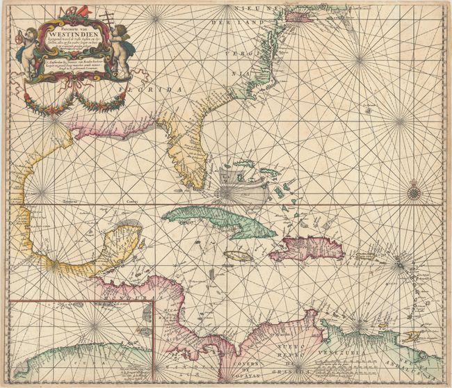
Van Keulen's elegantly engraved sea chart of the Gulf of Mexico and Caribbean was based on Hessel Gerritsz' map of the region published circa 1631, which influenced numerous derivatives. Gerritsz' inset of the northern coast of Cuba has been retained, but van Keulen makes considerable improvements to the coastline of the Mid-Atlantic region. Although these updates were likely derived from English sources, van Keulen retains the nomenclature Nieu Nederland, despite the fact that the Dutch had twice lost the region to the English. This chart is one of the first to incorporate these updated in the Mid-Atlantic based on English cartography. The map is adorned with a lovely title cartouche featuring putti, navigation instruments, and a draping garland. This is the second state with the privilege added to the title cartouche.
References: Burden #517.
Condition: A
A crisp impression on a bright sheet with a small stain in the inset, an area of printer's ink residue south of Cuba, and a manuscript cross added adjacent to St. Croix.