Subject: Southern Mexico & Central America
Period: 1597 (circa)
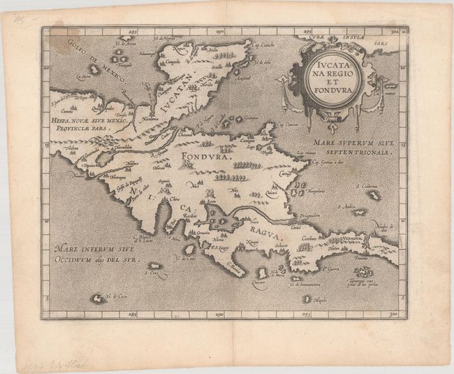
Publication: Descriptionis Ptolemaicae Augmentum
Color: Black & White
Size:
11.3 x 9 inches
28.7 x 22.9 cm
This fascinating map is from the first printed atlas relating exclusively to America. Wytfliet's work was referred to as a continuation of Ptolemy, despite the fact that there was little connection with Ptolemy except for his name on the title page. Wytfliet compiled his atlas using multiple published sources, including Ramusio, Hakluyt and De Bry. This map covers the Yucatan peninsula and Central America. Several over-sized rivers and lakes are prominently shown. A spurious R. Grande flows from a large lake in present-day Guatemala. Lake Nicaragua and the San Juan River are the dominant features in Central America. Another wide river nearly bisects the isthmus near Panama City. The map is adorned with a decorative strapwork title cartouche.
References: Kapp (MCC-103) #3; Mickwitz & Miekkavaara #307-11.
Condition: B+
A nice impression with light soiling and a stain at top left. A short centerfold separation confined to the top blank margin has been closed on verso with tape.