Subject: Virginia & West Virginia
Period: 1859 (dated)
Publication: A New Universal Atlas...
Color: Hand Color
Size:
15.8 x 12.8 inches
40.1 x 32.5 cm
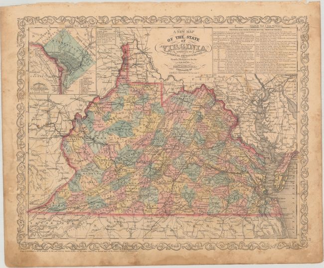
This attractive map bears the imprint of Charles Desilver and is filled with details of cities, roads and railways. Delineates and names counties with engraved line and hand coloring, including the new counties of Buchanan and McDowell in the southwest (established in 1858). At top right is an inset with the detailed explanation of the "Principal Rail Road & Stage Routes through Virginia" along with a second inset at left featuring a city plan of Washington D.C. The legend uses different lines to differentiate between operational railroads, those in progress and those planned. Fancy titling and decorative border.
References:
Condition: B
There is light scattered foxing with moderate soiling and staining that is more prominent in the margins. A short edge tear is confined to the lower right blank margin.