Subject: Houston, Texas
Period: 1957 (dated)
Publication:
Color: Printed Color
Size:
61.5 x 44.5 inches
156.2 x 113 cm
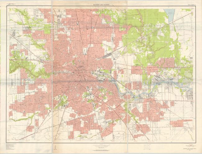
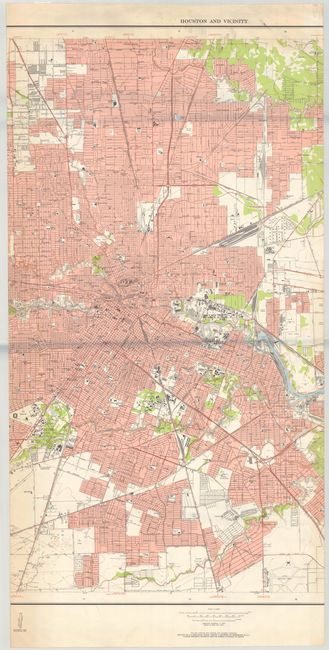
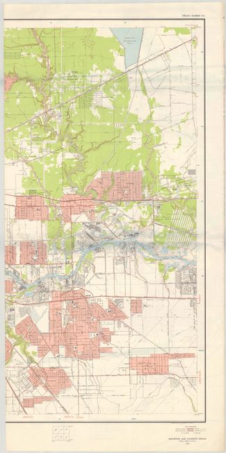
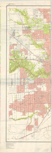
A mammoth map covering the broader Houston region. Includes remarkable detail of individual buildings, subdivisions, road types, municipal features, and even a drive-in theater. During the 1950’s the USGS published a series of “Metropolitan Area Maps” printed in five colors on a scale of 1 inch per 2000 feet. The map series included the latest survey data for 58 metropolitan areas with exceptional detail. The maps provide a snapshot of post-war American cities before most entered a period of accelerated growth.
References:
Condition: B+
On a bright sheet with some light extraneous creasing and a bit of soiling at top center. There is a "teaching set" stamp in the top left corner, just touching the map border. Due to the size of the map, each third of the map was scanned separately and the image was digitally merged. The map is one full sheet (not three separate sheets), and the images of each individual third are included as they are higher resolution than the digitally merged image.