Subject: Oklahoma
Period: 1901-07 (dated)
Publication:
Color: Printed Color
Size:
22 x 14.3 inches
55.9 x 36.3 cm
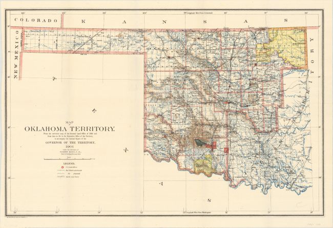
A. Map of Oklahoma Territory..., 1901. This map was compiled from the corrected map of the General Land Office 1898 and from data on file in the territorial office to accompany the Annual Report of the Governor of the Territory to accompany the Annual Report under the direction of Harry King, Chief of Drafting. It is an attractive map with great attention paid to detail, including railroads constructed and proposed, as well as roads and trails. The map covers present day western Oklahoma with the panhandle, but only the western portion of what was then Indian Territory is shown. Indian reservations within the territory are shown, including the Wichitas, Kiowas, Comanches and Apaches. Land Offices are located at Woodward, Alva, Enid, Perry, Guthrie, Kingfisher, Ft. Reno, Oklahoma City, Mangum and Lawton. Condition: (A)
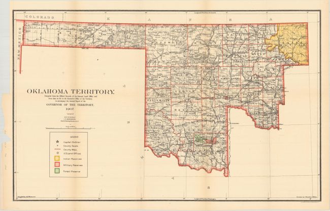
B. Map of Oklahoma Territory..., 1907. An updated version of the map that does not include Indian Territory to its east. This version no longer contains lands reserved for the Poncas, Otoes, and Missourias in the northeast and the Grazing Lands along the Red River have been eliminated. Compiled under the direction of I.P. Berthrong. Condition: Light toning with one tiny split at a fold intersection. (B+)
References:
Condition:
Issued folding. See description above for details.