Subject: New Mexico
Period: 1861 (dated)
Publication:
Color: Black & White
Size:
29.6 x 19.9 inches
75.2 x 50.5 cm
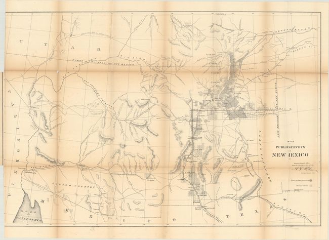
An early, large-scale, territorial map by the Surveyor Generals Office, Santa Fe, New Mexico. It includes all of today's Arizona and extends to show the northern reaches of the Sea of Cortez, southeastern California, and Utah to the north. Colorado Territory is not named as it was established the same year as this map. The area of present-day New Mexico is depicted with limited surveying, primarily around Santa Fe, Albuquerque, and along the valley of the Rio Grande River. Place names include El Paso, Dona Ana, Las Cruces, Fort Craig, Tuscon, Arizona City, Fort Breckenridge, and more. Most of Arizona is blank with little cartographic information save a few rudimentary rivers, two Indian Reservations, and mountain ranges. Hachuring indicates private and public land claims, and townships subdivided.
References:
Condition: B
Issued folding with light toning along the fold lines and several small fold separations that have been mostly closed on verso with archival tape. A bnding trim at left has cut away the neatline at top and bottom and two binding tears have been archivally closed on verso.