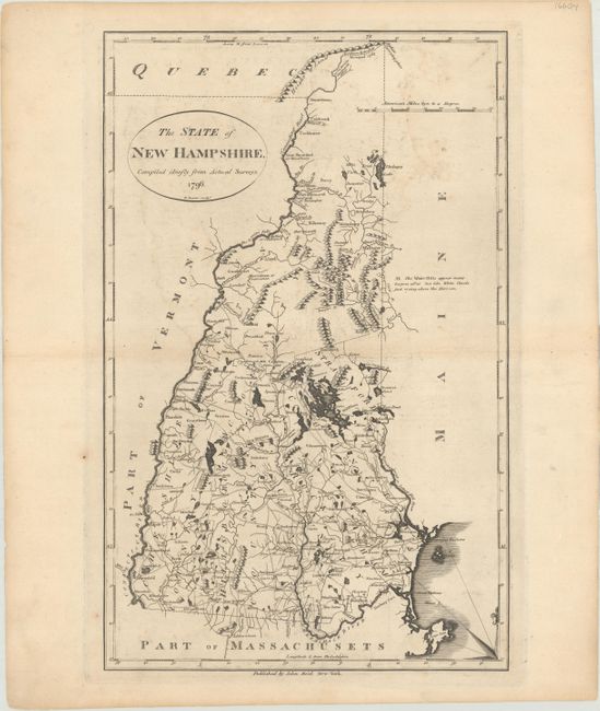
Subject: New Hampshire
Period: 1796 (dated)
Publication:
Color: Black & White
Size:
11 x 17.3 inches
27.9 x 43.9 cm
This map was copied from Mathew Carey's The State of New Hampshire Compiled Chiefly from Actual Surveys, 1795. It shows the state divided into five counties, all named. Includes good detail of the topography, watershed, towns and a surprisingly large network of early roads. A portion of a huge compass rose with fleur-de-lis is in the lower right corner. The notation (N.B.) says the "White Hills appear many leagues off at Sea like White Clouds: just rising above the Horizon." The head of the Sougegon River appears in a lake close to the five hills. Engraved by Benjamin Tanner and included in both Winterbothom's History of America and the American Atlas, both published in 1796.
References: Wheat & Brun #189.
Condition: B+
A dark impression with light offsetting and a few spots of foxing.