Subject: Florida
Period: 1836 (dated)
Publication:
Color: Black & White
Size:
10.8 x 14.9 inches
27.4 x 37.8 cm
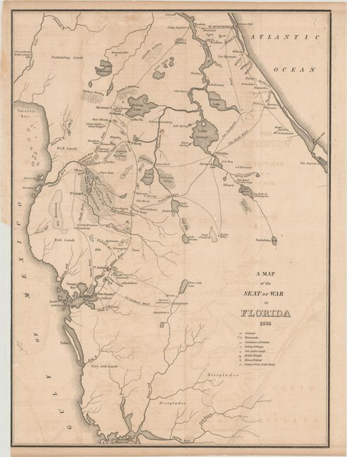
This is the first map by Major Gen. W. Scott to show the progress of the Seminole Wars. The map shows much of northern Florida from Charlotte Harbor in the southwest to St. Augustine in the northeast. Locates Tampa Bay, Lake George, Drums Lake, and numerous forts including Drane, Izard, Cooper, Alabama, and Brooke. Delineates the routes of Gen. Eustis, Col. Goodwin, plus the Military Road from Fort Brooke to Fort King. Locates swamps, fords, numerous small settlements, and a few battle sites. Many interesting place names like Negro Town, located northeast of Fort Cooper on the edge of the Great Swamp or the Cove of the Ouithlacoochee.
References: Claussen & Friis #152.
Condition: B
Issued folding with light toning and offsetting. There is a binding trim at left and an adjacent 1/2" binding tear that has been closed on verso with archival tape.