Subject: San Diego, California
Period: 1953 (dated)
Publication:
Color: Printed Color
Size:
46.8 x 64 inches
118.9 x 162.6 cm
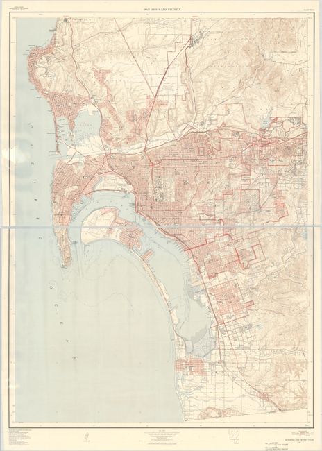
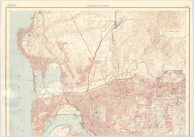
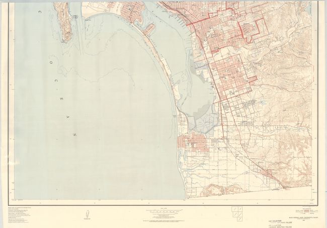
A mammoth map covering the broader San Diego region from the United States/Mexico border north to La Jolla. Includes remarkable detail of individual buildings, subdivisions, road types, municipal features, and much more. During the 1950’s the USGS published a series of “Metropolitan Area Maps” printed in five colors on a scale of 1 inch per 2000 feet. The map series included the latest survey data for 58 metropolitan areas with exceptional detail. The maps provide a snapshot of post-war American cities before most entered a period of accelerated growth.
References:
Condition: A
On a bright sheet with a bit of light extraneous creasing from being rolled. There is an old library stamp in the bottom blank margin. Due to the size of the map, each half was scanned separately and the image was digitally merged. The map is one full sheet (not two separate sheets), and the images of each individual half are included as they are higher resolution than the digitally merged image.