Subject: San Diego, California
Period: 1921 (dated)
Publication:
Color: Black & White
Size:
21.8 x 18.8 inches
55.4 x 47.8 cm
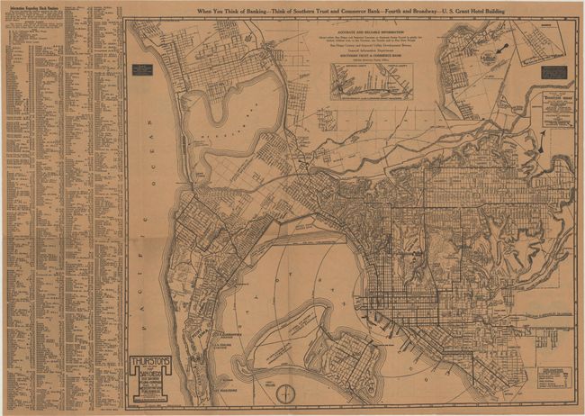
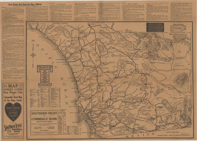
This promotional brochure was issued on behalf of the Southern Trust and Commerce Bank by the Western Map Company. The recto contains a highly detailed map of the San Diego area that extends from Coronado and Point Loma north to Mission Bay and Pacific Beach with an inset of La Jolla at top right. Drawn by D.C. McLain, the map shows electric railways, an "auto scenic trip," post offices, fire stations, schools, and more. The map notes $1.2 million of capital improvements for the U.S. Army Aviation School and $3.0 million for the U.S. Naval Air Station near Coronado. The verso contains a road map for the broader Southern California region with a legend identifying good roads, wagon roads, hotels, gas stations and more. Drawn by George Rock. Self-folding (3.7 x 8.7").
Thurston auto maps are scarce with only two institutional examples of this San Diego map found on OCLC.
References:
Condition: A
Issued folding on heavy brown paper.