Subject: Los Angeles, California
Period: 1922-23 (circa)
Publication:
Color: Black & White
A nice pair of early 20th century maps of Los Angeles County issued by the Automobile Club of Southern California.
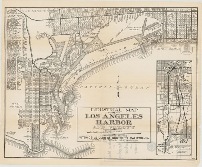
A. Industrial Map of Los Angeles Harbor and Vicinity, circa 1922, black & white (20.0 x 15.8"). Map features San Pedro and Long Beach and details the numerous industrial companies who occupy the inner harbor. A table at left lists the various company names and the associated berth numbers. An inset map at right shows the driving distances from downtown to points south including San Pedro and Long Beach. Condition: There are a few small splits at the fold intersections.
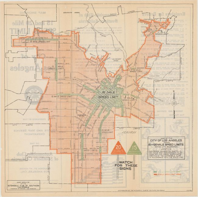
B. Map of the City of Los Angeles Showing 15 and 20 Mile Speed Limits Within City Boundaries, circa 1923, printed color (10.1 x 10.1"). Depicting the city proper, the map identifies those regions that have 15 and 20 mph speed limits with green and red shading. The verso contains 17 "reminders for drivers" and details pertaining to the automobile club, which at the time set up and maintained the speed limit signs. Condition: Faint toning along the vertical fold lines.
References:
Condition: B+
Issued folding. See description above for additional details.