Subject: Los Angeles, California
Period: 1903-16 (dated)
Publication:
Color: Printed Color
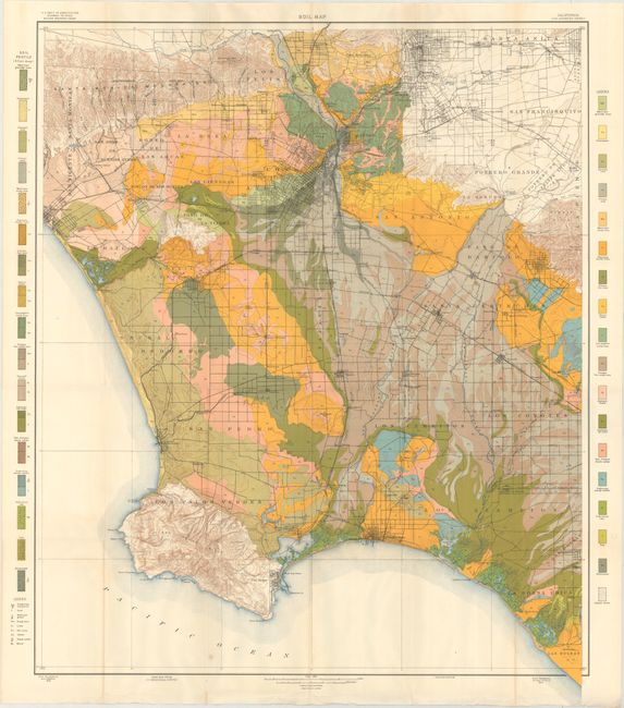
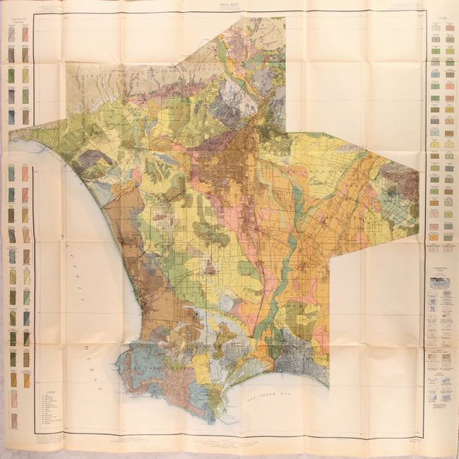
A nice pair of geological maps of the Los Angeles region issued by the Field Operations of the Bureau of Soils over a 13 year period. The maps shows the cities and roads between the Santa Monica Mountains, Whitter, Long Beach, and Los Palos Verde, the site of today's Rancho Palos Verde. Both are beautifully colored to match their respective legends. Together they show the rapid development of the Los Angeles area at the beginning of the 19th century.
A. Soil Map, dated 1903 (30.0 x 36.8"). Condition: A clean and bright example with a bit of extraneous creasing in the bottom blank margin. (A)
B. Soil Map - California - Los Angeles Sheet, dated 1916 (34.5 x 34.8"). Condition: Light toning with an edge tear at lower left that extends 6" into the image that has been closed on verso with archival tape. (B+)
References:
Condition:
Issued folding. See description above for additional details.