Catalog Archive
Auction 176, Lot 164

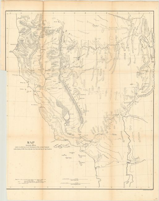
"Map Showing the Different Routes Travelled Over by the Detachments of the Overland Command in the Spring of 1855 from Salt Lake City, Utah to the Bay of San Francisco", U.S. Army

Subject: Southwestern United States

Period: 1856 (published)

Publication: Sen. Ex. Doc. No. 1, 34th Congress, 1st Session

Color: Black & White

Size:
18.7 x 22.1 inches
47.5 x 56.1 cm
Download High Resolution Image
(or just click on image to launch the Zoom viewer)

This uncommon map accompanied the "Report of Capt. R. Ingalls on the march of L. Col. Steptoe from Ft. Leavenworth to California" in 1854 and 1855. Wheat states "it is a document of first quality ….. showing three important routes." Steptoe was looking for a new and shorter route from the Great Salt Lake to the Pacific Coast. In addition to the route chosen by Steptoe, the routes of two detachments are also traced - one under Capt. Ingalls, the other by Lt. Mowry. The map extends to include all of California and part of Oregon to above the Rogue River. It stretches eastward to name G.S. Lake City, the Mormon capital of Fillmore, Cedar City and Fort Yuma on the Colorado.

References: Wheat (TMW) #868; Wagner & Camp #256.

Condition: B

Issued folding and now flattened and backed with tissue. There is minor foxing, light toning along the fold lines, and the sheet has been trimmed to just inside the border at left.

Estimate: $120 - $150

Sold for: $110

Closed on 2/12/2020

Archived