Subject: Northwestern United States
Period: 1869 (circa)
Publication:
Color: Hand Color
Size:
16.9 x 13.7 inches
42.9 x 34.8 cm
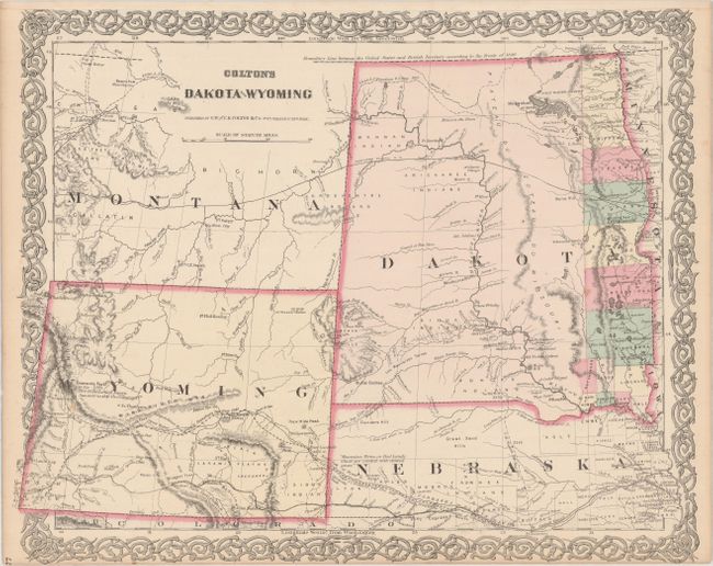
This is a relatively uncommon and early edition of this map issued just after the establishment of Wyoming Territory. It is the first atlas map to name Wyoming in the title and to show its correct territorial configuration. This new territory has no county organization and only a few settlements outside of the many forts and army posts. The partially completed Union Pacific Railroad reaches Bridger's Pass. Fremont's Peak is noted as "This is the Loftiest known Summit in this chain." Dakota Territory has only 13 counties organized along the eastern border with the balance of the territory still firmly in the hands of the Indians. A string of forts are shown along the Missouri River. Numerous trails and exploration routes are noted including part of the Pony Express route, Fremont and Stansbury's routes, Northern Pacific and Union Pacific Railroads and the Great Route to California and Oregon (Oregon Trail).
References:
Condition: A
A few faint spots, else fine.