Subject: Northwestern United States
Period: 1861 (published)
Publication: Sen. Ex. Doc. No. 1, 37th Congress, 2nd Session
Color: Black & White
Size:
33.6 x 24 inches
85.3 x 61 cm
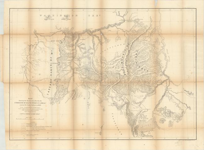
Extensive and detailed map of the area east of the Deschutes River, extending to the Snake River, and from the desert southeast of Lake Harney to the Columbia River. The map represents a decisive military action against the Shoshones, who were defeated during this campaign. Details many exploration routes, emigrant and Indian trails, camps, battlegrounds, and forts including Boise, Walla Walla, Dalles, Cascade, and Vancouver. Portland appears as a rather small community. Clearly shows the Oregon Trail (labeled the Immigrant Road) with springs along the way. Several large regions are marked as Unexplored. Lithographed by Julius Bien & Co. on a scale of about 12 miles to the inch. The map was drawn by Lieut. Joseph Dixon of the Topographical Engineers under the direction of Capt. G. Thom.
References: Wheat (TMW) #1016.
Condition: B
Issued folding with light toning and minor foxing. There are a number of small fold separations along the top two horizontal folds with small loss at one fold junction, and a 2" puncture along the left vertical fold with no image loss.