Subject: Mississippi, Louisiana & Arkansas
Period: 1835-38 (circa)
Publication:
Color: Hand Color
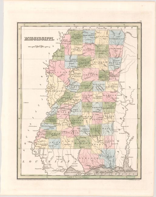
A. Mississippi, dated 1838 (11.1 x 14.1"). A handsome, early map of Mississippi that details the county seats, towns and settlements, and river systems. County development is current to 1836, with the addition of Bolivar and Coahama counties in the western part of the state. The northern boundary with Tennessee shows both the "old state line" and "new state line." Not to be confused with the maps from the Comprehensive Atlas, this map is several inches larger and carries much more information. Engraved by Stiles, Sherman & Smith. Condition: Fine. (A+)
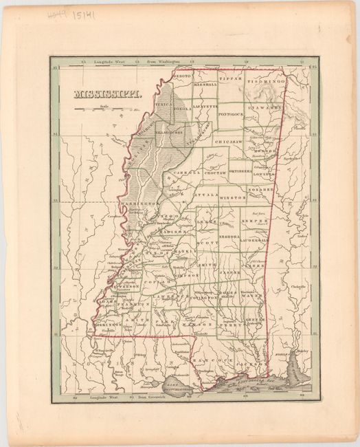
B. Mississippi, circa 1835 (7.8 x 9.9"). This is the smaller edition issued in the Comprehensive Atlas, with county development current to about 1835. The formerly non-county area of the northwestern part of the state now shows county names including Bolivar and Coahama (1836). Locates county seats, the river systems, and little more. Condition: There is a hint of toning. (A)
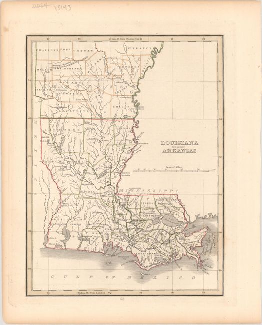
C. Louisiana and Part of Arkansas, circa 1835 (7.8 x 10.2"). A simple, but attractive, map delineated by parish/county that was published one year before Arkansas' statehood. It shows good detail along the coast including marshes and bays, and depicts numerous towns and settlements. One railroad (the West Feliciana Railroad) is depicted running from St. Francisville, Louisiana to Woodville, Mississippi. Only a few settlements are noted in Arkansas. Condition: There is a hint of toning. (A)
References:
Condition:
See description above.