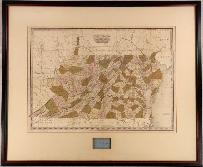
Subject: Mid-Atlantic United States
Period: 1840 (dated)
Publication:
Color: Hand Color
Size:
28.3 x 19.9 inches
71.9 x 50.5 cm
This is the pocket version of Tanner's map of the region that was first published in his American Atlas, which is considered to be one of the finest American atlases ever published. Delineated by county, the map is filled with detail of cities and towns, wagon roads, drainage and topography. Blue overprinting identifies canals, while red and yellow overprinting shows existing and proposed railroads. County development is current to 1837 with the creation of Mercer County in the southwestern portion of the state, but prior to Greene County in central Virginia (1838). The map is dated 1840 and the copyright date is 1839 in the imprint at bottom left.
The frame measures approximately 39x33" and includes an encased blue slip of paper containing the signature of a "Pierce Butler" dated 1840. This is possibly the signature of Pierce Mason Butler (1798-1847) who was Governor of South Carolina from 1836-38. In 1847, he died in battle during the Battle of Churubusco during the Mexican–American War.
References:
Condition: B
Issued folding with some faint offsetting and small fold separations. The map is rippled and appears to be glued down to a board, but has not been inspected outside of the frame. Sold as is and not subject to return.