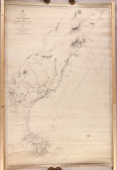
Subject: South Island, New Zealand
Period: 1857 (dated)
Publication:
Color: Black & White
Size:
25.2 x 38.3 inches
64 x 97.3 cm
This chart spans the stretch of coast from Cape Campbell to Banks Peninsula on New Zealand's South Island, with nice detail around Pegasus Bay. The waters are filled with depth soundings, bottom types, tidal information, notes on currents, and much more. There is fine topographical detail along the coasts. Several interesting place names and notes appear inland, including the town site of Christchurch, numerous rivers and plains, the "Principal Road to the West Coast," the Nelson Province, and "Extensive Sheep Country." The chart is based on the surveys of Captain J.L. Stokes, Commander G.H. Richards, and others made in between 1849 and 1851. Additional information was drawn from the explorations of J.W. Hamilton. It was reduced from original drawings by Edward J. Powell. Engraved by J. & C. Walker, published by the Hydrographic Office of the British Admiralty, and sold by J.D. Potter.
References:
Condition: B
A crisp impression with moderate soiling and some small stains. There are several short edge tears, including one that just passes the neatline at bottom, and some manuscript notations in pencil. Wood pieces on sides in image are not attached to the map.