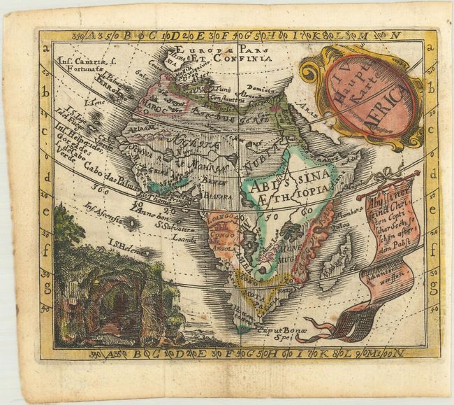
Subject: Africa
Period: 1733 (circa)
Publication: Neuer Atlas von XXIX Hauptkarten
Color: Hand Color
Size:
5.3 x 4.4 inches
13.5 x 11.2 cm
This uncommon little map is from a history and geography book for Catholic students. The map identifies major regions, rivers and a few cities. The source of the Nile River is depicted as two twin lakes south of the Equator There is a vignette of mummies outside a cave and a banner explaining that Abyssinians are Coptic Christians and subjugate to the Pope. Desing was an eighteenth century Benedictine monk of Ensdorf who devoted his life to scientific studies and was a member of the Bavarian Academy of Sciences.
References: King (2nd ed.), p. 168; 210.
Condition: A
Clean and bright, issued folding on watermarked paper.