Catalog Archive
Auction 175, Lot 61

"A New Map of America, from the Latest Authorities", Cary, John

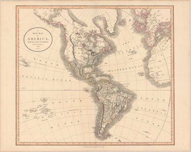
Subject: Western Hemisphere - America

Period: 1806 (dated)

Publication: New Universal Atlas…

Color: Hand Color

Size:
20.7 x 18.2 inches
52.6 x 46.2 cm
Download High Resolution Image
(or just click on image to launch the Zoom viewer)

This large map of the Americas features Aliaska in a rudimentary form. The United States is confined to the east of the Mississippi River. A huge mountain range labeled the Stony Mountains bisects the western part of North America, which is depicted as completely unexplored with a few suspected rivers delineated by dotted lines. California is named New Albion. The map extends to show the Sandwich Islands, Britain and Europe, and West Africa.

References: Phillips (Atlases) #736-51.

Condition: A

A sharp impression with contemporary outline color on paper with an "1804" watermark and some insignificant soiling.

Estimate: $275 - $350

Sold for: $220

Closed on 11/13/2019

Archived